Walk a day, live a week – Indian proverb
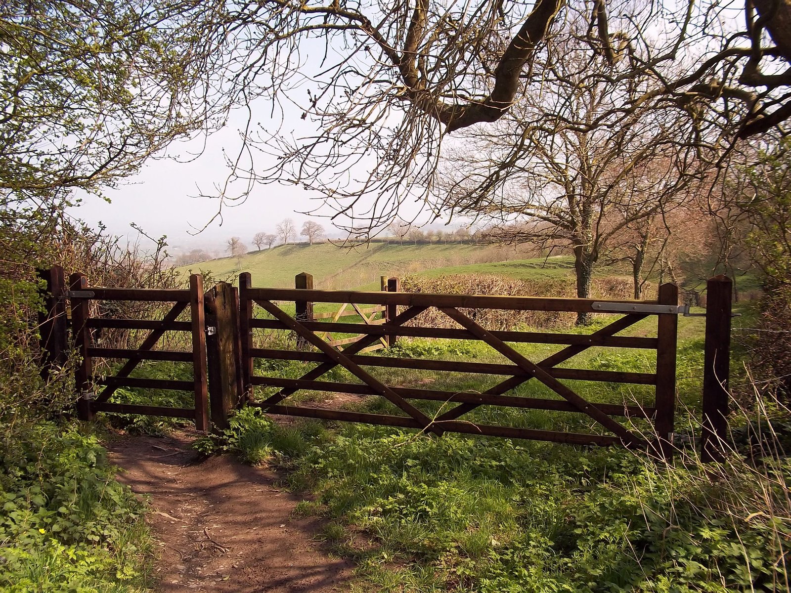
For those who are able, walking is a great way to explore Glastonbury and enjoy the beauty of the surrounding countryside. From family oriented town trails to day long hikes, there is something for everyone who wants to explore on foot. A range of guided walks are also available for visitors to give an insight to the many different facets of Glastonbury – from history to spirituality, from ley lines to trees. For long distance walkers, 4 long distance paths pass through Glastonbury – the Celtic Way, Mary Michael Pilgrims Way, Samaritans Way and Somerset Way and one long distance path that ends in Glastonbury – the King Arthur Way from Tintagel Castle to Glastonbury Abbey. For lovers of long walks Glastonbury has its own long distance walk – Beating the Bounds, details of which are provided towards the end of the article.
In this article I cover walks in and around Glastonbury – town trails, guided walks and long distance paths will be covered in future articles.
Most of the maps and books featured in this article are available from the Glastonbury Information Centre which we encourage visitors to support. Please check availability of a publication before visiting if there is a particular publication you want for your visit. Links to purchase the featured maps and books are included for those who want a copy before they visit.
The Glastonbury Way
![]()
New for 2021 Glastonbury has its own guided walk that is a must if you want to explore Glastonbury on foot. The Glastonbury Way starts and ends at the Glastonbury Information Centre and is a 7.5-mile guided route around the town and offers opportunities for people of all walks of life to either immerse in pilgrim practices or simply enjoy an interesting walk.
Walking and experiencing the Glastonbury Way, offers you the opportunity to discover just what makes Glastonbury such a unique place, drawing people to visit from all around the world. Glimpses into the history, myth and legend of various sites is included on interpretation boards whilst benches offer places to rest, breathe and enjoy the living landscape.
A detailed map of the walk can be purchased from the Glastonbury Information Centre and more information on the walk can be found in The Glastonbury Way Facebook group here.
Maps
The books and guides featured in this article have enough detail to get you round the routes covered, but serious walkers will not want to leave home without a proper map in their backpack.
If you want a map and only plan on walking in the Glastonbury area, our recommendation is Around & About Baltonsborough Butleigh & Glastonbury Tor by Yellow Publications. ‘Around and About’ maps are ideally suited to visitors looking to take a short walk in the area. Based on Ordnance Survey’s Explorer mapping magnified from the standard 1:25 000 scale, to a much clearer 1:16 000, these maps really make navigation trouble-free. The clarity helps the user to spot interesting features so easily missed on a normal map. The key features of this map are:
- Easy to read mapping at a scale of 1:16 000 (approx 4 inches to a mile)
- Laminated for weatherproofing
- Useful scale ruler for distance and walk time
- Slips easily into your pocket
Around & About Baltonsborough Butleigh & Glastonbury Tor can be purchased online here
Walkers planning on venturing further afield will need the Cheddar Gorge & Mendip Hills West Wells & Glastonbury 141 – Explorer 1:25 000 scale which can be purchased online here
Ordnance Survey 1:50K Landranger maps can be viewed for free online on the Saturday Walkers Club website here
Finally, Somerset County Council have produced a series of 20 walking and cycling maps to help people to explore the county. The maps are free and the Glastonbury and Street map can be downloaded here warning: some of the information on the back of this map is dated but the map is current).
Kim von Coels of The Krumble Empire has produced a series of maps of Glastonbury town which can be downloaded from here. Colour versions of these maps are available from the Glastonbury Information Centre.
Books
There are plenty of books covering Glastonbury walks to choose from. Here is what is currently (2020) available:
- Walking Around Glastonbury: A Tour in a Book by Vanda Lloyd (ISBN: 978-1539785675) (2016)
Easy to follow walks around Glastonbury with accompanying photographs to help guide you. Includes suggested walks giving views of Glastonbury Tor in the surrounding area.
There are no maps or drawn routes in this book – the routes are described using lots of small photographs with captions giving directions. In terms of presentation this book has the look and feel of a schoolboy project complete with spelling mistakes and the detail is basic but ‘it does what it says on the tin’ and will get you around Glastonbury.
There also a pocket size version of the same book (ISBN: 978-1985196711) (2018)
- Walking Around Glastonbury Tor by Vanda Lloyd (ISBN: 978-1979650991) (2017)
Designed to compliment Walking Around Glastonbury, this book concentrates on the area of the Tor and the lanes immediately surrounding it. It is meant as a guide, ‘Tour in a Book’, for those who are short on time and want to explore the are around Glastonbury Tor.
- Walking Close to Glastonbury and the City of Wells by Clive Brown (ISBN: 978-1907669330) (2005 reprinted 2018)
‘No frills’ local walking guide booklet with ten varied and interesting circular walks close to Glastonbury and Wells. Walks include Cheddar, Wookey, Street, Ebbor Gorge and Pilton with simple but detailed instructions and clear pencil drawn maps. The walks range from 5 to 7 miles (8 km to 11 km) in length and the one Glastonbury and Glastonbury Tor walk is 5.75 miles (9 km) in length.
Walking Close to Glastonbury and the City of Wells can be purchased online here
- Stride, Shuffle or Crawl – A Glastonbury Walk by Barb Drummond (ISBN: 978-0956290076) (2010)
This book provides an introduction to the history of the town, the Abbey and the aftermath of the latter’s destruction, and the short lived spa. The walk begins at the bottom of High Street but being a circuit it can be joined at any point. At the top of High Street a slight detour can be made to Bove Town, and further detours can be made to Gog & Magog and Wearyall Hill. It includes old drawings and modern colour photographs and a map.
Stride, Shuffle or Crawl – A Glastonbury Walk can be purchased online here
- Somerset and the Mendips Walking Guidebook – OS Pathfinder Guides by Ordnance Survey
Enjoy 170 miles of idyllic country walks through Somerset and the Mendips, from sea views of Bridgwater Bay to dramatic Avon Gorge and Cheddar Gorge and enchanting Wells and Glastonbury. Take your pick of 28 hand-picked routes, graded by length and difficulty, through England’s wonderful west. Includes a 7 mile walk around Glastonbury.
Somerset and the Mendips Walking Guidebook can be purchased online here
- Glastonbury Footpath Walks by Glastonbury Conservation Society
Possibly the original book dedicated to walks around Glastonbury. This book describes 12 walks (plus some variants) ranging in length from 3 miles to 8.5 miles (5 km to 13.5 km) each with a black and white OS map. The book is packed full of information about the history of places along the routes which is great if you want to learn about Glastonbury’s rich history. Originally published in 1976 and reprinted several times since this book is dated but the wealth of historical information in this book is still relevant today.
The 12 walks featured are:
- Bushy Coombe, Lynches, Tor
- Holywell Lane, Wick Gulley, Gog and Magog, Old Wick Lane
- Wearyall Hill, The Holy Thorn, The Abbey Mill, The River Brue
- Outlying areas including Woodlands Priory site and Ponter’s Ball Earthworks
- Wearyall Hill, Aqueduct Crossing, Old Canal and Railway
- Abbey Barn, Plunging, Chapel’s Field, The Old Fairfield
- Bove Town, Slipper Chapel, Paradise Lane, Gog and Magog, Maiden Croft Lane, Folly Lane
- St. John’s Church, North Binne, The Lake Village, Northload Bridge, Grist Lane
- Stone Down, Wick, Holywell Lane
- Brick Works, Tin Bridge, Brindham
- Bove Town, Norwood Park, Ponter’s Ball, Chapel’s Field
- Monks Path, Fish House at Meare, Old Canal Bank or Meare Pool
Glastonbury Footpath Walks is available from the Glastonbury Information Centre.
Guides
The Avalon Marshes Heritage Walks are 12 circular heritage walks to help you get the best out of the area. These walks will take you to wonderful views, fascinating heritage, attractive villages and much more and the free guides can be accessed online or a copies collected from the Avalon Marshes Centre.
Two of the walks are based in the Glastonbury parish:
- Wearyall Hill, Beckery and the Brue – Moderate 4 miles (6.5 km)
Starting at the Red Brick Building in Glastonbury this walk includes industrial heritage and ancient legends. Wearyall Hill gives fine views of the Tor, the Avalon Marshes and the hills beyond.
Wearyall Hill, Beckery and the Brue can be downloaded here
- Glastonbury Tor to the Old Oaks – Moderate 3.5 miles (5.5 km)
This walk takes in wonderful views from the top of the Tor to the ancient landscape of the old oaks, Gog and Magog, and the hedges of Stone Down Lane.
Glastonbury Tor to the Old Oaks can be downloaded here
The other Avalon Marshes Heritage Walks guides can be downloaded here
The Avalon Marshes Centre is at Shapwick Road, Westhay, BA6 9TT (W3W: hats.life.habits)
Beating the Bounds
Last but by no means least is Glastonbury’s own long distance walk. This one is for the serious hikers. Beating the bounds is an ancient custom still observed in some English and Welsh parishes. A group of old and young members of the community would walk the boundaries of the parish, usually led by the parish priest and church officials, to share the knowledge of where they lay, and to pray for protection and blessings for the lands. To commemorate the 250th anniversary of Queen Anne granting Glastonbury a Royal Charter in 1705, in 1955 mayor Henry Scott-Stokes instigated a set of boundary stones around the Glastonbury parish to replace those that had disappeared. In 2012 as part of the Queen’s Diamond Jubilee celebrations, the Glastonbury Conservation Society organised a repeat of the traditional ‘beating the bounds’ walk around Glastonbury’s old parish boundary (see map below).
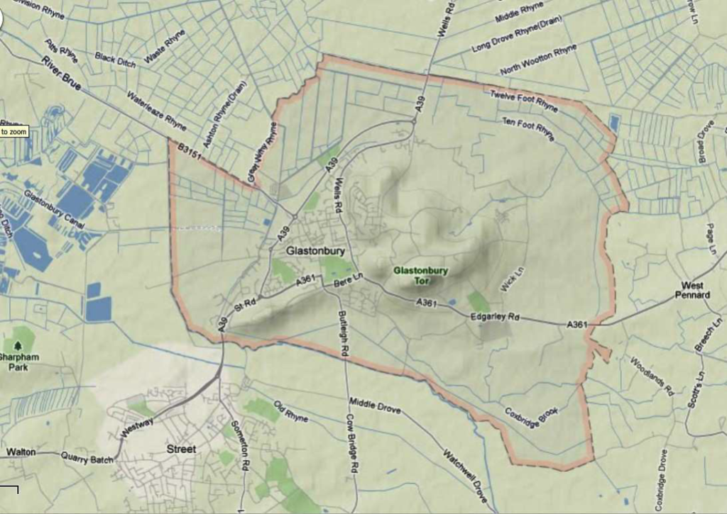
Map of Beating the Bounds route from the Glastonbury Conservation Society Newsletter July 2012
Ring The Syren Bells
10 mile route from the Bishop’s Palace in Wells to Glastonbury Tor waymarked by 9 limestone standing stones. Each standing stone is unique and contains a bronze arch supporting a bell. Each bell is a different note creating a 10-mile long musical instrument. During 1998 and 1999 sculpture Barry Cooper and musician Laurence Parnell collaborated on the 9 waymarkers for a Wells/Glastonbury route for cyclists and walkers, sponsored by Sustrans and the National Lottery in partnership with Foster Yeoman Limited. In July 1999, 300 school children led by Adam Hart-Davis, a television science and cycling enthusiast, made a one-day pilgrimage from Wells to Glastonbury.
Do you know of any good walks, books or guides you could share with other walkers visiting the Glastonbury area?
To book holiday accommodation in the Glastonbury area visit here


Very useful information. This will expand my repertoire of walks around here (although no doubt you have run them all!). Thank you Tom!