The Glastonbury Cycleway
The Glastonbury area has much to offer cyclists, much of which has been covered in earlier articles on this blog (search under the Cycling category). 2021 saw the launch of The Glastonbury Way, a 7.5 mile guided walk around Glastonbury which is a wonderful way to explore the area on foot. In a similar vein, I thought it would be a good idea to document a route for cyclists to explore the area that I call The Glastonbury Cycleway.
How I Derived the Route
There are two documented cycle routes through the town centre: National Cycle Network Route 3[1] and the Bittern Trail (ignoring the bits of the incomplete Route 26). The Glastonbury Cycleway includes all of Route 3 that passes through the parish, plus all of the Bittern Trail. To connect Route 3 and Bittern trail this route takes cyclists through 2 National Nature Reserves (and along the boundary of a third) and provides an insight into the landscape of the Avalon Marshes as it once was; vast reed-beds, lakes and pools, wet woodlands and raised bogs now home to lots of wonderful wildlife.
[1]The section of Route 3 passing through Glastonbury forms part of the EuroVelo 1 (EV1), named the Atlantic Coast Route, which is a 5,087 mile (8,186 km) long-distance cycling route running from North Cape in Norway to Sagres in Portugal.]
The Route
The Glastonbury Cycleway is an 18 mile (29 km) long mixed terrain circuit around the Glastonbury area and the route includes several refreshment stops and points of interest along the way to break up the adventure.
To show directions, print the map and directions and download the route to a GPS file or image, play the route (right arrow in centre of map) and use the drop-down menu in the top RH corner of the map. To hide the route map labels, turn labels off via the Display drop-down menu – Enjoy!
To print a route guide or download the route files e.g. gpx, click on the A plotaroute.com B link in the bottom RH corner of the map above. To print this article, use the buttons at the bottom.
Refreshment Stops
- R 1 – Fara – cafe in former police court great for brunch, Turkish eggs and French toast with bacon – if you don’t want to stop so soon in the ride, Fara is worth the short trip back down Benedict Street at the end!
![]() soils.assume.regularly
soils.assume.regularly
WWW: Fara – Facebook
- Detour R 2 – The Old Tannery – restaurant & bar in former tannery offering fresh and seasonal menus for breakfast, lunch, and dinner – worth a visit!
![]() upper.hits.proclaims
upper.hits.proclaims
WWW: The Old Tannery
T: 01458 440558
- R 3 – Miller’s Morsels Café – catering unit with sit down service great for a full English breakfast and bacon butties
![]() appealing.science.slowly
appealing.science.slowly
WWW: Miller’s Morsels Café – Facebook
T: 07929 087260
- R 4 – RSPB Ham Wall – selection of prepacked snacks, hot and cold drinks and ice creams
![]() stags.trifling.begins
stags.trifling.begins
WWW: RSPB – Ham Wall
T: 01458 860494
- R 5 – Railway Inn – pub great for beer and skittles
![]() dine.summaries.tricky
dine.summaries.tricky
WWW: Railway Inn – Facebook
T: 01458 860223
- R 6 – Marshes Hub Tea Stop – cafe great for tea and cake
![]() hats.life.habits
hats.life.habits
WWW: Marshes Hub Tea Stop
T: 07727257798
- R 7 – The Dairy At Westhay – dairy farm great for fresh whole milk and milkshakes
![]() corkscrew.paradise.same
corkscrew.paradise.same
WWW: The Dairy At Westhay – Facebook
T: 07711 434165
- R 8 (& I 20) – Sweets Tea Rooms – cafe great for tea, cake and breakfasts and cyclists
![]() book.overpaid.flown
book.overpaid.flown
WWW: Sweets Tea Rooms
T: 07830 211544
- R 9 – Double-Gate Farm – tea room great for an afternoon tea
![]() amphibian.shorts.scrubber
amphibian.shorts.scrubber
WWW: Double-Gate Farm – Tea Room
T: 01458 832217
- R 10 – The Sheppey Inn – pub great for local ales and ciders and a Sunday Roast
![]() mega.yacht.urban
mega.yacht.urban
WWW: The Sheppey Inn
T: 01458 831594
- R 11 – Middlewick – holiday cottages with a farm shop and cafe good for enjoying a coffee and a slice of home-made cake or an ice cream on the terrace
![]() suspect.inversely.showrooms
suspect.inversely.showrooms
WWW: Middlewick Holiday Cottages
T: 01458 832351
- Detour R 12 – Glastonbury Ales – Beer Shop – microbrewery that produces craft beers and ciders and also home of Glastonbury Spring Water – beer, cider or water to go you choose?
![]() digests.lurching.haunt
digests.lurching.haunt
WWW: Glastonbury Ales
T: 01458 830750
- R 13 – Heaphy’s Café – cafe great for a drink while watching the world go by (and buskers in the Market Place)
![]() poodle.typified.requested
poodle.typified.requested
WWW: Heaphy’s Café – Facebook
T: 01458 837935
*** When planning pit-stops, always call ahead to check opening times and availability. ***
Points of Interest
- I 1 – Market Cross – Glastonbury’s cross replaced an earlier structure of early 16th Century origin, described as having been “of some antiquity”, octagonal with clustered pillars, a central column, and a roof. It fell into a state of disrepair and was demolished around 1806. Later in the 19th century, the proprietor of Glastonbury Abbey, proposed that a new market cross be erected on the same site. It was erected in 1846 and has undergone restoration in 2005.
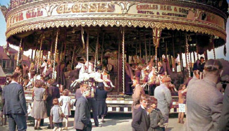
The building on the corner with Benedict St, now home to Heaphy”s Cafe, was the birthplace of Charles ‘Bungy’ Heal 1879 -1950 known as The King of Showmen and a blue plaque on the wall records this.

Cross at Glastonbury (1806)
- I 2 – Benedict Street – Medieval ‘Madeload’ [lode = watercourse crossing or wharf] from c1850 to c1950 was known as Station Road as it connected the town centre to the railway station.
- I 3 – Birthplace of Charles ‘Bungy’ Heal – The building that is now home to Heaphy’s Café was the birthplace of Charles ‘Bungy’ Heal. Known as the ‘King of Showmen’ Charles Heal was born in this building in 1879. By 1908 Charles was the proprietor of a steam roundabout and built up a good business, travelling one of the biggest and most splendid sets of galloping horses in the country and is remembered as a generous benefactor to many. In honour of Charles ‘Bungy’ Heal a blue plaque is fitted on the (Benedict Street) side of the building.
- I 4 – Church of St Benedict – The church was originally a chapel dedicated to St Benignus and retained this until the middle of the 17th Century. Bishop Benignus was a great friend and disciple of St Patrick and became his successor.
In 1091 the monks of Glastonbury took the relics of a holy man named Beon or Beonna by boat from Meare to be added to the collection at Glastonbury Abbey; at his last resting place, an oration was delivered, and, after a liberal offering, a church was built on the site, being consecrated around 1100. Unfortunately, the monks confused Beon the hermit of Meare with Benignus and the dedication was to St Benignus rather than St Beon.
Around 1500 the Norman chapel was completely rebuilt by Abbot Richard Beere (1493-1524). Beere’s monogram can be seen over the north porch, which also contains a little window used by lepers to receive the holy sacrament, and on one of the unique roof corbels.
Henry Fielding English novelist and dramatist and founder of the Bow Street Runners, London’s first intermittently funded, full-time police force is believed to have been baptised at the church in 1707.
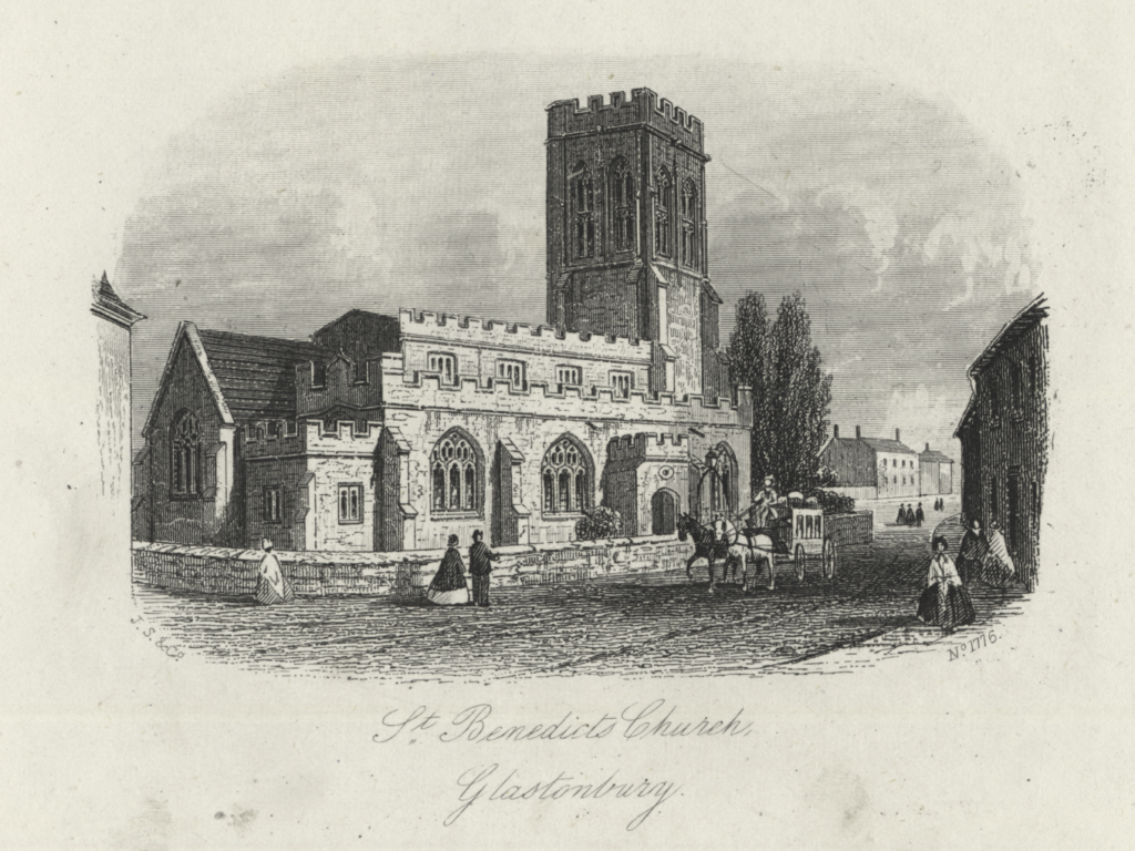
St Benedict’s Church (Mid-19th Century)
- I 5 – Somerset Constabulary Headquarters – The building now known as Abbots Court was once the headquarters of the Somerset Constabulary. Until 1856 the Glastonbury Borough Police only had two part-time constables to police the borough. In 1856 the Somerset Constabulary was formed and the Glastonbury Borough Police was consolidated into the new constabulary around the same time. The headquarters of the constabulary, including offices and houses, had been built in Benedict Street by 1860. In 1910-1911 offices were converted to a court house for petty sessions and today is home to the Fara (see R 1) .

Somerset Constabulary Headquarters (c1870)
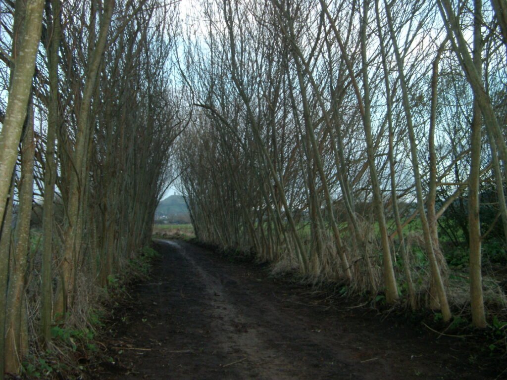
- Detour I 6 – Bride’s Mound – Slightly off the route but worth a visit if you decide to take the detour and have time. Bride’s Mound is a small hill of archaeological, historic, and mythological interest and was once home of St Patrick, Glaston’s first abbot and site of the earliest monastic settlement in the UK.
- I 7 – The Pollards – The old brick building on the right (as you enter Porchestall Drove) with the 3 large chimney stacks is known as the Pollards and was built around 1850 alongside Glastonbury railway station as offices for the Somerset Central Railway (later the Somerset and Dorset Joint Railway) and was once the Railway Hotel.

The Pollards
- I 8 – Amy’s Picnic Area – Passing through the gate at the start of the Willow Walk is a picnic area created in memory of Amy Thomas. A peaceful area with beautiful views and equipped with picnic benches and parasols and a bike rack this is a the perfect place to relax with or without a picnic. Please visit The Amy Thomas Tribute Fund to make a donation in Amy’s memory – thank you.
- I 9 – Glastonbury Willow Walk – The Willow Walk lies on the track bed of the former Somerset Central Railway line. The Somerset Central Railway line opened on 28th August 1854 running from Glastonbury to Highbridge Wharf. Glastonbury was then an important manufacturing town, but its location made the transport of goods difficult. Coastal shipping was still dominant for transport and the Bristol Channel ports of Bridgwater and Highbridge were about 18 miles (29 km) away. From here the line continued for a short distance to Glastonbury station (behind you as you enter the gate to the Willow Walk).
The Willow Walk is a long corridor edged with Willow trees alongside the former Glastonbury Canal created by volunteers who helped plant the 3000 ‘stools’ and ‘wands’ in rows, circles and arcs of different colours and varieties.
Glastonbury Willow Walk
- I 10 – Aqueduct Bridge – Known locally as Acky Duck Bridge, the bridge carried the Somerset and Dorset Railway (formerly the Somerset Central Railway) line over the River Brue. The existing structure dates from August 1903 when it replaced the original bridge. Featuring a single span, it comprises a pair of wrought iron ‘hogback’ trusses – 43 feet (13 metres) in length – with mild-steel corrugated floor plates.
The bridge takes its name from the aqueduct that stood to the North (on right as you follow route) of the bridge carrying the Glastonbury Canal over the River Brue. The Glastonbury Canal ran for approximately 14 miles (23 km) through two locks from Glastonbury to Highbridge, where it entered the River Parrett and from there the Bristol Channel. The canal was authorised by Parliament in 1827 and opened in 1834. It was operated by The Glastonbury Navigation & Canal Company. Most of it was abandoned as a navigation in 1854, when a railway was built along the towpath. The aqueduct was described as having three arches, the river passing under via a syphon. The aqueduct has long gone, but the stone abutments remain, together with remnants of ironwork (cast iron plates embedded in the masonry).

Train crossing Aqueduct Bridge
- I 11 – Aqueduct Cottage – Known as Aqueduct Cottage, this was the railway crossing keeper’s cottage where the Somerset and Dorset Railway crossed the road until the last service ran on 7th March 1966.
- I 12 – Sharpham Crossing – Another road crossing for the now closed railway and another keeper’s cottage in an area that is still known as Sharpham crossing.
- I 13 – Ham Wall National Nature Reserve – Since the last Ice Age, decomposing plants in the marshes of the Brue valley have accumulated as deep layers of peat that were commercially exploited on a large scale in the 20th Century. Consumer demand eventually declined, and in 1994 the landowners, Fisons, gave their old workings to Natural England, who passed the management of the 260 hectares (640 acres) Ham Wall section to the RSPB.
- I 14 – Ashcott Railway Station – was a station on the Highbridge branch of the Somerset and Dorset Railway. Opened by the Somerset Central Railway in 1856 as Ashcott and Meare, the name changed to Ashcott in 1876. Consisting of a short wooden platform and station building, the station was next to a road level crossing. This was operated with a 10 lever ground frame.
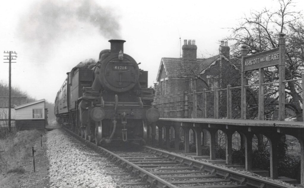 British Railways engine 41214 at Ashcott and Meare Station – built in Crewe in September 1948 and withdrawn from service on 31st July 1965
- I 15 – Shapwick Heath National Nature Reserve – Shapwick Heath is a 394 hectare (973.6 acre) former raised bog lying in the basin of the River Brue that is now a biological Site of Special Scientific Interest. Shapwick Heath is part of the Brue Valley Living Landscape conservation project. The project commenced in January 2009 and aims to restore, recreate, and reconnect habitat. It aims to ensure that wildlife is enhanced and capable of sustaining itself in the face of climate change while guaranteeing farmers and other landowners can continue to use their land profitably. Shapwick Heath is managed by Natural England.
- I 16 – Sweet Track (site of) – Since 1873 forty-five groups of prehistoric wooden trackways have been discovered, connecting the Somerset archipelago of islands, ranging in date from the Neolithic to early Iron Age. The most famous of the trackways was the Sweet Track which crossed the 2 km of reed swamp that separated the island of Westhay with the Polden Ridge. It was named after Ray Sweet who discovered it in 1970 while ditch cleaning. The Sweet Track was built in the spring of 3806 B.C. and was constructed with a mix of oak, lime, ash, and hazel dominated by huge oak trees up to 400 years old, one metre across, with trunks up to 20 metres before the first branch.
An even earlier trackway, called the Post Track, was built in 3838 B.C. along the same line as the Sweet Track making it one of the oldest engineered roadways in the world. The Sweet Track did get an entry in the Guinness Book of Records as the oldest road in the world until the discovery in 2009 of a trackway built in 4100 B.C. in another part of the UK. Many deliberately placed objects were found beside the Sweet Track, including a polished jadeite axe from the Alps that had taken several hundred years to arrive in Somerset but had never been used or hafted before it was deposited. These ritual offerings suggest the track was the earliest structure in the UK linked to a religious function. Experience walking in the footsteps of prehistoric people by walking the small section of trackway that has been recreated along the line of the original Sweet Track.
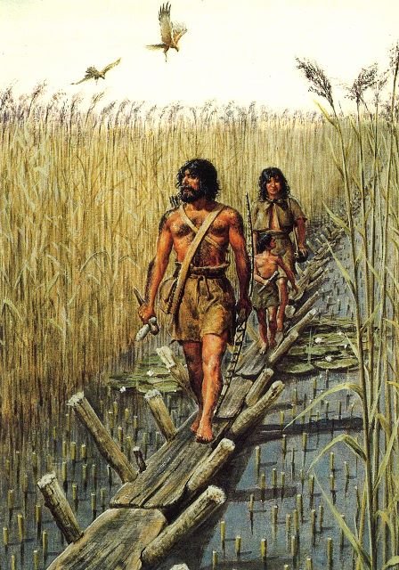 Neolithic man traversing the marshes
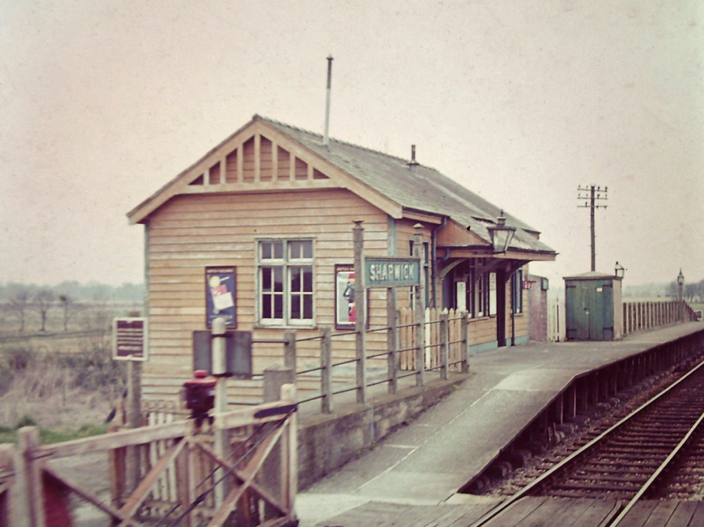
- I 17 – Shapwick Railway Station – Opened in 1854, the station was two and a half miles from the village of Shapwick and appeared in some early timetables as “Shapwick Road”, though this does not seem to have ever been an official name. The station was closed, with the rest of the branch, on 7th March 1966.
 Shapwick Station as it once was
- I 18 – Avalon Marshes Visitors Centre – The Avalon Marshes Centre sits at the heart of Somerset’s Avalon Marshes. Owned and managed by Natural England the centre has a visitor information point, café, gallery and craft shop, replica historic buildings, car park and toilets.
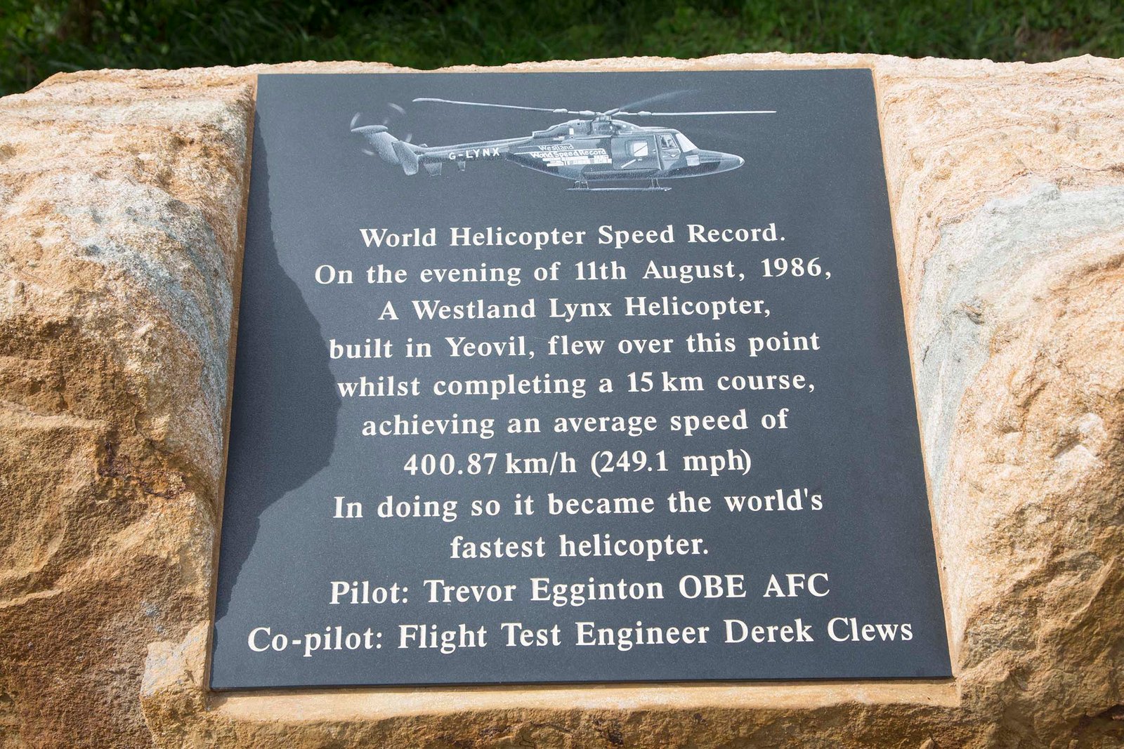
- I 19 – World Helicopter Speed Record Plaque – Over this spot on 11th August 1986 a Lynx helicpter averaged a speed of 400.87 km/h while completing a 15km course and in doing so became the world’s fastest helicopter. A plaque at this location was unveiled on 11th August 2016 to mark the 30th anniversary of the record.
- I 20 – Westhay Tollhouse – The Wedmore Turnpike Trust was created in 1827 to link the two Great Western roads through Somerset. Its main responsibility was a single road across Sedgemoor. On the Cheddar to Glastonbury Road there was a tollhouse at Westhay and the building still stands to this day. The two windows enabled the turnpike toll collector to see approaching traffic (horses and carts in those days). The building has tilted over due to being built on peat, though it is inhabited and in good condition.

Westhay Tollhouse in 1974
- I 21 (& R 8) – Sweet’s Peat and Science Museum – Little known hidden gem full of curiosities that you just won’t see elsewhere. A lifetime of collecting, a family history of working the levels and a love of peat industry heritage on the Levels is collected together here at Sweets Tea Rooms. ‘Merv’ Sweet has gathered together some very unique artifacts including parts from a crashed WW1 bomber, retro radios and items that have revealed themselves from the peat works over the years. If you are interested in local history and industry then you simple must take a look!.
- I 22 – Westhay Moor National Nature Reserve – Westhay Moor is a 513.7-hectare (1,269-acre) biological Site of Special Scientific Interest and part of the Somerset Levels and Moors Special Protection Area under the EU Birds Directive. Westhay Moor is managed by the Somerset Wildlife Trust.
- I 23 – Godney Pillboxes – The GHQ Line (General Headquarters Line) was a defence line built in the United Kingdom during World War II to contain an expected German invasion. The British Army had abandoned most of its equipment in France after the Dunkirk evacuation. It was therefore decided to build a static system of defensive lines around Britain, designed to compartmentalise the country and delay the Germans long enough for more mobile forces to counter-attack. Over 50 defensive lines were constructed across the country. Godney was incorporated into the GHQ Line and several pillboxes were constructed in the area. Natural obstacles to tanks were supplemented with an anti-tank ditch and bridges in the area were prepared for demolition at short notice. Thankfully, the line was never used and after the cessation of hostilities farmers were offered £5 for each structure they demolished. This was no easy task, given the amount of concrete and brick that filled these very solid defences, so they were left to the elements to decay.
![]() prefer.open.stiffly and scream.fish.roaming
prefer.open.stiffly and scream.fish.roaming
- I 24 – The River Sheppey – Previously known as Doulting Water or the River Brae, but has been called the Sheppey since the late 19th century. The river’s source is St Aldhelm’s Well at Doulting, which joins with other headwaters to form the main flow. The Sheppey is a tributary of the River Brue, and flows into the Decoy Rhine and then the River Brue near Westhay. The Sheppey has been used to power local industry, such as corn and textile mills in the Shepton Mallet area.
- I 25 – Lake Village (site of) – Glastonbury Lake Village is an Iron-Age village situated 5 km north west of Glastonbury. Discovered by Arthur Bulleid in 1882, Glastonbury Lake Village was the best-preserved Iron Age village ever found in Europe and was probably occupied for about a century between 200 and 100 B.C. Despite what the name suggests the settlement had not been built in a lake but was in fact created at the edge of a patch of birch, alder, and willow trees, in the midst of a large swamp of reed, sedge, open water and wet woodland that stretched all the way to Glastonbury.
A total of forty roundhouses in about six groups were discovered. Constructed from reeds, hazel, and willow 5-8 metres in diameter, the roundhouses only lasted for 8 or 9 years and there was probably a maximum of fourteen houses in use at any one time housing a population of around two hundred people.
The villagers were surprisingly skilful, had quite advanced tools and could work lead, iron, bronze, copper and even glass. They relied on careful husbandry for their existence and grew wheat, barley, peas, and beans, trapped animals and birds, and kept domestic animals. It is not known why the people settled here but it may have been because of the protection offered by the encompassing swamp or the dietary importance of the fish and birds that lived in it. The site was probably on an important waterborne trade route from central Somerset to the Severn estuary.
Although these marshes have long since been artificially drained, the excellent preservative properties of the peaty wetland soils in the Glastonbury area left an archaeological legacy of international importance. The range of everyday items of Iron Age life discovered at the settlement is staggering.
![]() (Corner of site of Glastonbury Lake Village nearest to Glastonbury town centre) destroyer.albums.everyone
(Corner of site of Glastonbury Lake Village nearest to Glastonbury town centre) destroyer.albums.everyone
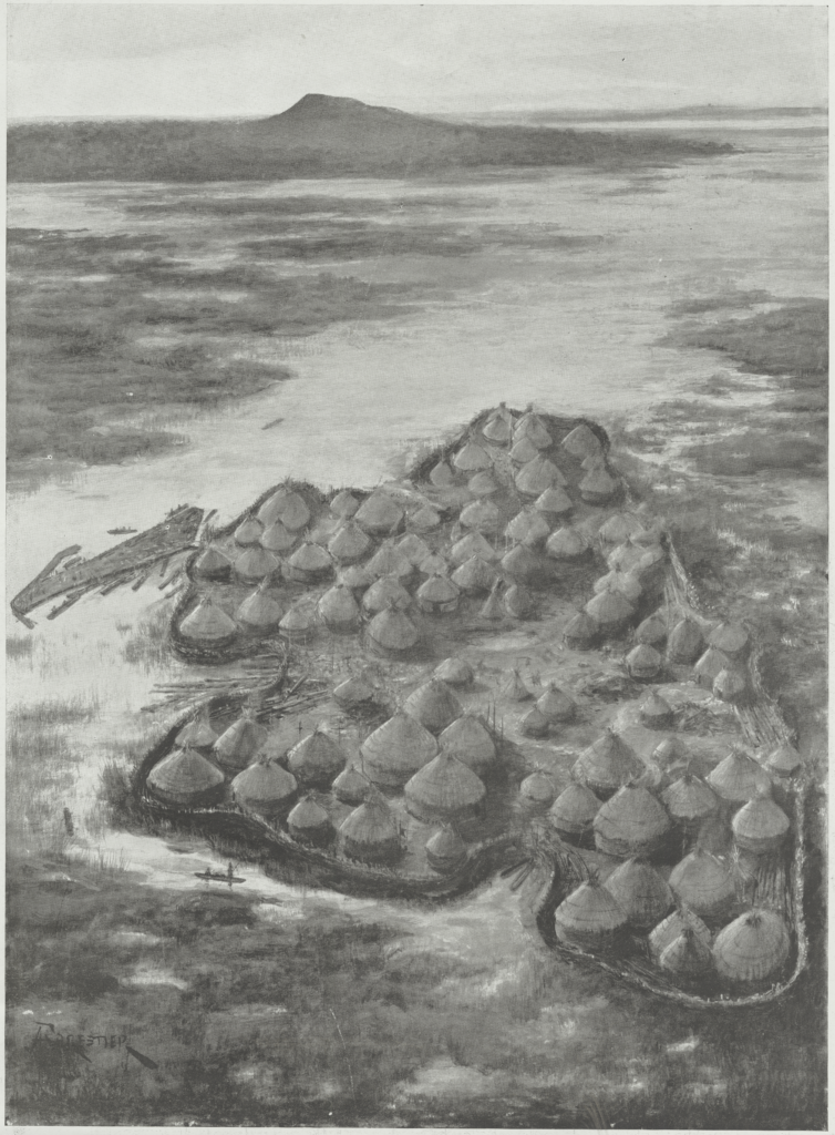
The Ancient British Lake Village Near Glastonbury (The London Illustrated News – December 2 1911)
- I 26 – Glastonbury to Wells Railway Line – Two thirds of the way along Chasey’s Drove, the drove passes over a hump and it was at this point that the railway line between Glastonbury and Wells crossed the drove; you can make out the route of the raised track bed crossing the field to the left.
A branch of the Somerset Central Railway between Glastonbury and Wells was opened on 15th March 1859. This had originally been planned to be part of a main line extension towards Frome, where the Wilts, Somerset and Weymouth Railway could be joined, giving the yearned-for access to the South Coast towns, but the Somerset Central thought that joining up with the Dorset Central Railway would be a more cost-effective option. The line closed on 29th October 1951.
- I 27 – Hartlake Turnpike (site of) – Turnpike trusts were bodies set up by individual acts of Parliament, with powers to collect road tolls for maintaining the principal roads in Britain from the 17th but especially during the 18th and 19th Centuries. At the peak, in the 1830s, over 1,000 trusts administered around 30,000 miles (48,000 km) of turnpike road in England and Wales, taking tolls at almost 8,000 toll-gates and side-bars. The Wells trust, of which the Hartlake Turnpike was part, operated between 1753 and 1883. Turnpikes declined with the coming of the railways and then the Local Government Act 1888 gave responsibility for maintaining main roads to county councils and county borough councils. The date on the current marker stone is probably not correct as the Wells trust was not established until 1753.
*** Take extra care when crossing the sometimes busy (A39) road from Chasey’s Drove to Wells Road ***

Hartlake Turnpike (site of) 1950s available from Bath In Time here
- I 28 – Tin Bridge – The ‘Tin Bridge’ has long gone but the roundabout retains the name of the bridge that stood here, built here to carry the Wells road over the Somerset Central Railway in 1859 and demolished when the Glastonbury relief road was built in 1993.

Tin Bridge before demolition
- I 29 – Norwood Park Farmhouse – Norwood Park had been created from inclosed woodland by 1305–6 and had formed a significant part of Glastonbury manor throughout the Middle Ages. Norwood Park was the largest deer park belonging to Glastonbury Abbey and according to records, after the Dissolution of the Monasteries, Norwood Park was 4 miles round and the ‘very good and sweet’ herbage supported 800 deer. Norwood Park Farmhouse is in the centre of Norwood Park and was built around 1480 as a residence for the abbots of Glastonbury (Grade II listed).
*** From here you follow the Ordnance Survey map version of Route 3, or continue along Wick Lane and up Gypsy Lane to follow the signposted version of Route 3 which is slightly longer, slightly less steep and less lumpy (plus you get to go past the beer shop hidden behind the Tor!) ***
- I 30 – Glastonbury Tor – One hundred and fifty-eight metres high and topped by the roofless St Michael’s Tower, the iconic and evocative hump of Glastonbury Tor is visible for miles around and provides Somerset with one of its most unmistakable landmarks acting as a beacon for travellers approaching the town. The Tor with its distinctive terracing was represented in the opening ceremony of the London Olympics and this iconic landmark was once featured on the cover of Reader’s Digest The most amazing places to visit in Britain and on a 1st class postage stamp (in 2011). The Tor is known as one of the most spiritual sites in the country and lots of myths surround the Tor including that it is the location of the Holy Grail and is the entrance to Avalon, the land of fairies. The strange terracing around the Tor has aroused curiosity for hundreds of years, as it is not known whether they were used for crops, defence or as some sort of sacred labyrinth for pilgrims. Archaeologists believe the terraces are lynchets – artificial terraces made to aid cultivation.
![]() (Glastonbury Tor – North Gate) zooms.vowed.bandstand
(Glastonbury Tor – North Gate) zooms.vowed.bandstand
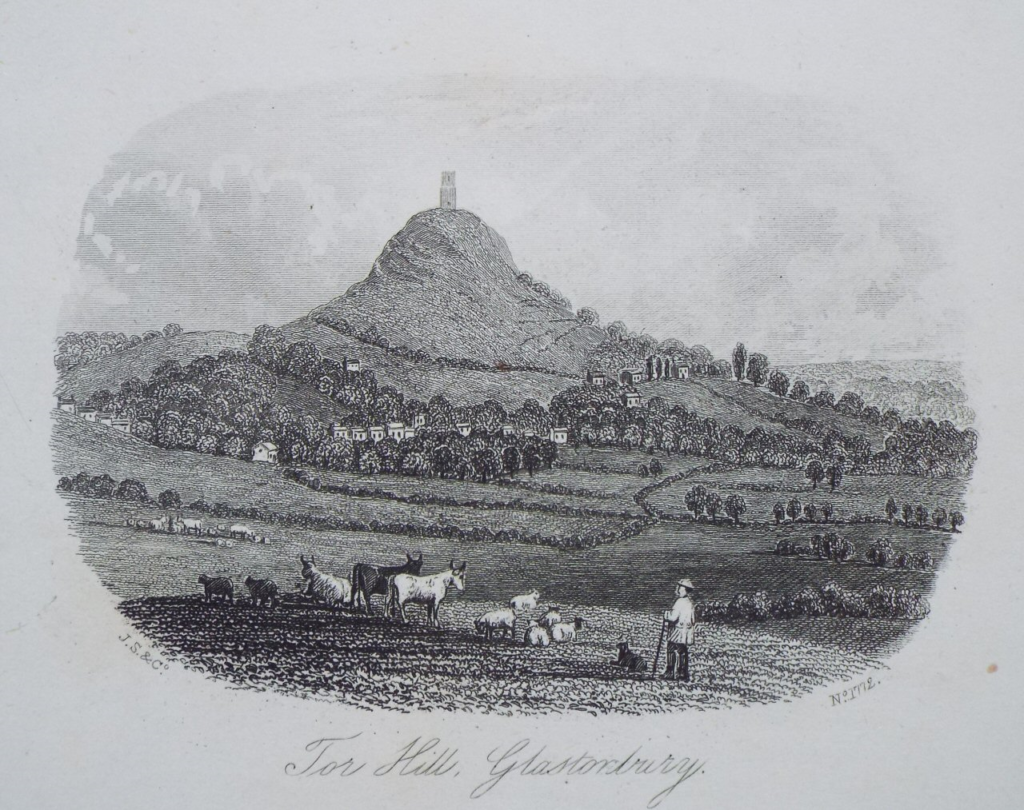
Tor Hill, Glastonbury (Mid-19th Century)
- I 31 – St. James’ Slipper Chapel
As you glide down Bove Town, look out for Jacoby Cottage at number 7 (half way down on the right). This is one of the few remaining medieval buildings in Glastonbury and used to be St. James’ Slipper Chapel where pilgrims left their slippers to climb the Tor in barefoot as penance. There used to be slipper chapels at the Beckery and near Drapers factory on Chilkwell Street but St. James’ (now a cottage) is the only survivor.
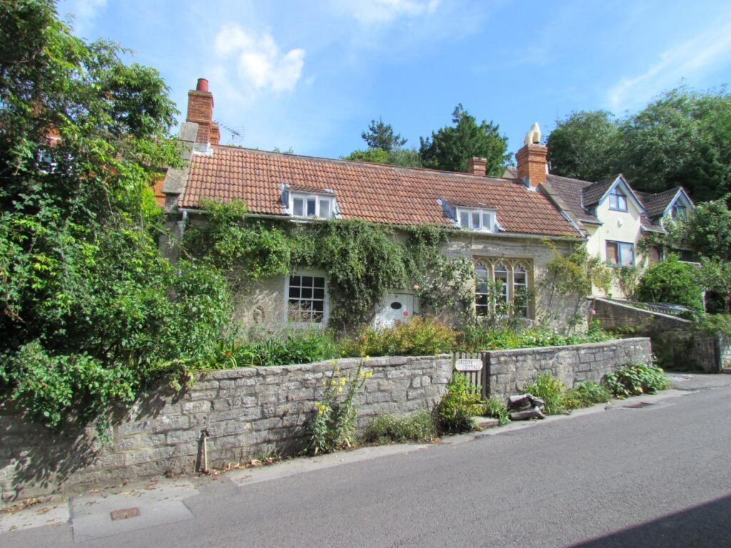
Jacoby Cottage, formerly St. James’ Slipper Chapel
- I 32 – Church of St John the Baptist – The present Church of St John the Baptist dates from the 15th Century and is a Grade I listed building. According to legend, the original church was built by Saint Dunstan in the tenth Century. The church was used for shelter by Monmouth’s troops in June 1685 during the Monmouth Rebellion. It is also recorded that on four occasions between 1800 and 1804, French prisoners of war were locked up for the night inside the church, presumably whilst in transit.
The Church of St John the Baptist is located halfway up High Street and offers a peaceful space away from the hustle and bustle of High Street but close enough to watch the world go by.
The church has a magnificent tower, the second tallest in Somerset at 41 metres, that is home to nesting peregrine falcons – the fastest member of the animal kingdom with the highest recorded speed of 389 km/h.

St John’s Church (Mid-19th Century)
More Information
Bittern Trail – Avalon Marshes
National Cycle Network – Route 3 – Sustrans
If you have done this route, please share your experience with others by leaving a comment below – thank you.
To book holiday accommodation in the Glastonbury area visit here